
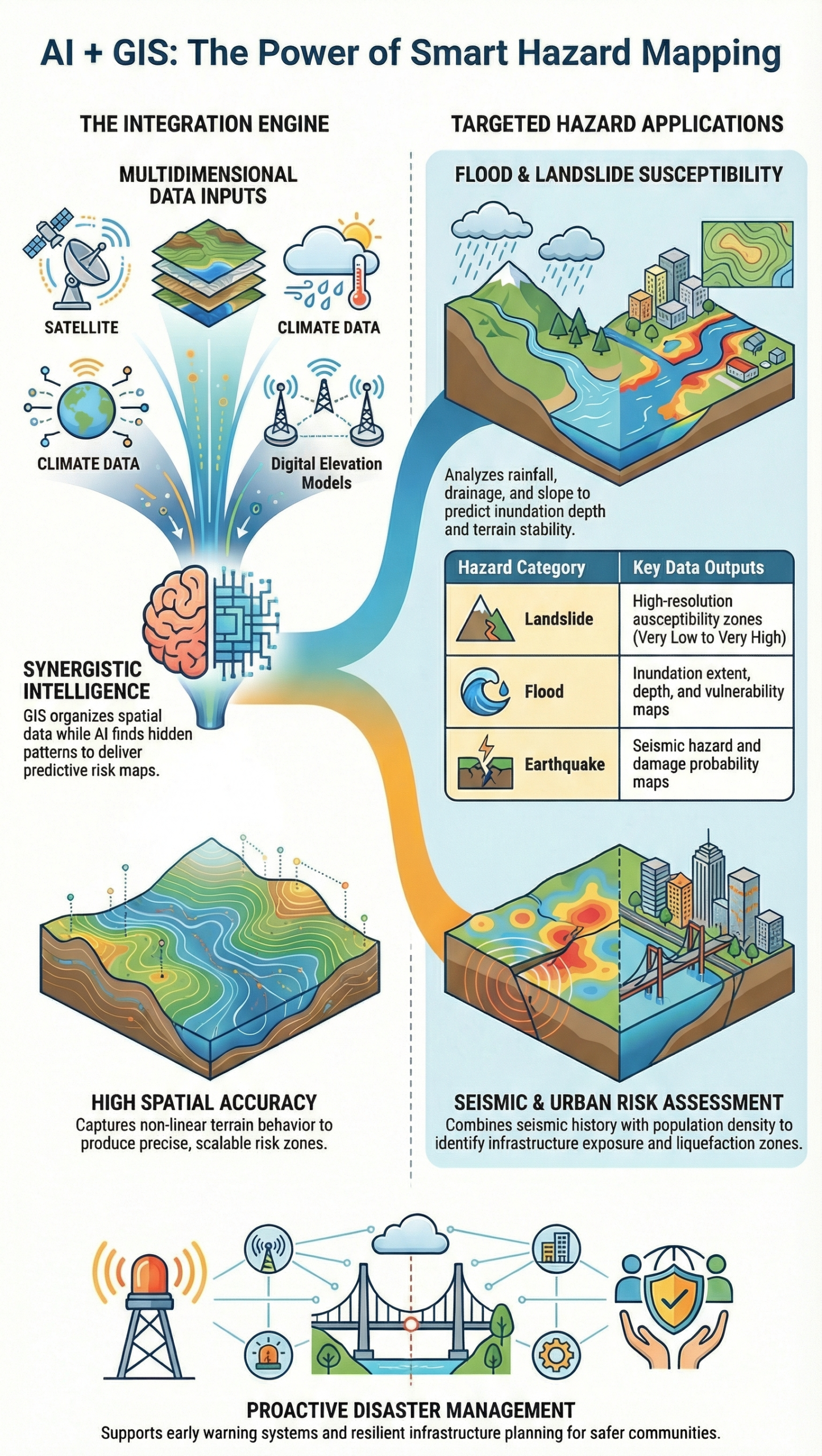
This infographic explains how the integration of Artificial Intelligence (AI) and Geographic Information Systems (GIS) is transforming hazard mapping into a smarter, faster, and more reliable process. By combining spatial data management with intelligent pattern recognition, AI–GIS frameworks enable accurate identification of high-risk zones and support proactive disaster planning.
The infographic highlights key applications of AI–GIS in landslide susceptibility, flood risk mapping, earthquake hazard assessment, and urban risk analysis. GIS provides the spatial foundation by organizing terrain, environmental, geological, climatic, and infrastructure data, while AI analyzes complex, non-linear relationships that traditional methods often fail to capture.
For landslides, AI learns from historical events and terrain factors to generate high-resolution susceptibility maps. In flood mapping, AI processes rainfall, drainage, elevation, and land-use data to predict inundation-prone areas. Earthquake risk mapping integrates seismic parameters, soil conditions, and infrastructure exposure to estimate potential damage zones. Urban risk mapping combines population density, land use, and critical infrastructure data to assess multi-hazard vulnerability in rapidly growing cities.
The infographic also emphasizes the advantages of AI–GIS integration, including faster analysis, improved spatial accuracy, reduced human bias, and the ability to update risk maps as new data becomes available. Rather than replacing traditional engineering knowledge, AI enhances decision-making by providing data-driven insights.